1.
Location and Size
The Bolgatanga
District is located within the Upper East Region of Ghana on latitudes
10°30’ and 1°55’ North and Longitudes 0°33’
and 1°00’ West. It has a land area of 1,620 km². The District
is boarded by North: Bongo, South: West and East Mamprusi Districts (N/R):
Kassena-Nankana District East: Bawku West District.
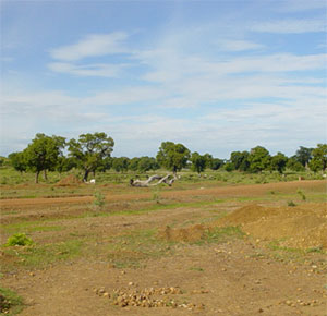
2. Topography and Drainage
Flat characterised by gentle slopes ranging from 1% to
5% with inselberg outcropped uplands with more than 10% slope. Major rivers
include the Red and White Volta tributaries. Other drainage systems include
rivulets, streams, dams and dugouts.
3. Climate
Alternating wet and dry seasons
Rainy Season: May to October
Dry Season: October to March with harmattan winds in November and December
Mean Annual Rainfall: 950mm – 1100 mm
Temperatures: Maximum: 45°C in March/April, Minimum: 12.8ºC in
August
Relative Rainfall Variability: 17% (Wet season) Rainfall very erratic.
Humidity: 91% (July to September), 15% (December to March)
4. Vegetation
Guinea Savannah Woodland consisting of short deciduous
trees widely spaced and a ground flora composed of different species of
trees and shrubs. Bushfires are a persistent feature of environmental
degradation and deforestation.
Economically important tree species – sheanut, dawadawa and baobab
trees.
5.
Geology and Minerals
District falls
within the Birrimain rocks of Ghana. Minerals Deposits:
Gold Deposits along Nangodi Zug – Dushi, Sheaga and Kalbeo –
Sherigu areas. Manganese deposits between Nangodi and Dushi and North-West
of Pwalugu. Large deposits of clay throughout the District; Zaare, Gambigbo,
Zanlerigu, Yikine, Kalbeo and Pwalugu.
Granite deposits at Tongo and Sekoti suitable for stone quarrying.
6. Soils
Soils developed over granites and sandstones
Good arable soils suitable for cereal cultivation
Moderately good soils for grazing and deep alluvial soils for vegetative
irrigation.
Ecology
Guinea Savannah Zone with a single rainy season in a year. Vegetation
is of a Guinea Savannah type.
7. Agriculture and Land
Use
Land basically allocated for farming, grazing, forest
reserves, settlements, road network, water reservoirs, etc. Main crops
cultivated millet, guinea corn, groundnut, tomatoes, etc. Average farm
size 0.4 -1.2 ha. Mode of Acquisition - Inheritance, chief, family
head.
8. Natural Resources
Land for agriculture purposes, labour, minerals deposits,
water bodies for fishing and irrigation and few forest reserves.
9. Demography
District predominantly rural (85%) except Bolgatanga and
Tongo with population of more than 5,000 people. Rural Population –
85%.
Population 1960 - 150,028
1970 - 172,202
1984 - 237,393
1995 (Estimated 328,608
1996 –
Population Growth Rate - 3.0%
National Population Growth Rate 2.8%
Population Density (1995) - 203 persons per km².
Bolgatanga (the only urban centre). Regional and District
capital had a population of 49,748 (1995 population Estimates).
10. Household Size
Ranges from 2-4 (small), 5-9 (Medium) and 10 and above
(large). Households largely headed by men. Large household sizes of 5
–13 are not uncommon in the district.
11. Occupational Distribution of Labour
Force
Agriculture: 57%
Trade and Commerce: 19%
Manufacturing: 11.9%
Community/Social Service Sector: 7.4%
Others (i.e. mining, quarrying, construction, utility services, etc.):4.55%
Dependency ratio: 1:101
12. Settlements
Major - Bolgatanga, Tongo, Zuarungu, Sekoti, Yikine, Sumbrungu,
Sheaga,
Nangodi, Kongo, Winkogo, Pwalugu and Pelungu.
Ethnicity - Gurunne, Nabdam and Talensi
13. Social Development
Festivals:
Golgo celebrated by Tongo and Tenzuk communities.
Daa, Naba-Yesiga, Bogram Goo, Tingama, Sinyaga and Adaakoya are thanksgiving
at Post-harvest celebrations by the Baare, Sherigu, Sekoti, Tongo, Balungu,
Pwalugu and Bolgatanga people respectively.
Family Inheritance: Patrilineal system
Education:
i. Institutions: Pre-school - 30, Primary - 81, JSS - 44, SSS - 5, Technical
- 1, Vocational - 1
Total - 162
ii. School Enrolment by Circuits in Bolga District (Nursery/Day Care,
Primary and JSS)
iii. Enrolment ratios
iv. Staffing Position: - 75.9% of total teacher population is in the Bolgatanga
Schools with the remainider being in the rural schools.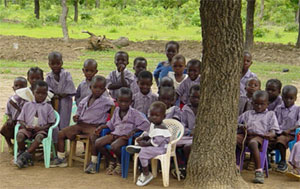
v. School Structures
vi. State of furniture
a. Number of schools furnished
b. Number of schools not furnished
c. Furniture requirement
vii. Other indications
Health
Top four (4) prevalent diseases -Malaria, Anti Respiratory Infection
(ARI), Diarrhoea diseases and skin diseases.
Health Facilities:
- Distribution fairly good. Services consist of public, private and non-Government
institutions and herbalist. Presently there are 19 health institutions
in the district. Staffing of
Health Facilities -averagely satisfactory
Water Supply
Urban water system, pipe borne limited to Bolgatanga Township.
Rural system is undertaken by COWAP, Rural Aid and covers mainly rural
settlements. GWSC provides water through the treatment plant at Gowrie,
two (2) mechanised and 331 hand pump bore holes.
Sanitation
The District has inadequate liquid and solid waste disposal facilities.
Public toilets are limited to Bolgatanga Township in a very deplorable
state. Sanitation in the rural areas also not satisfactory. Other
Social Services and Amenities
The District also has limited social amenities in the rural areas.
Rural communities lack electricity, postal and telephone, recreational
and sporting and proper sanitary facilities. These amenities exist only
in the Bolgatanga Township.
14.
Structure of Local Economy There is a
large agricultural sector most at the subsistence level, which accounts
for 80% of the income of people. Crop/Livestock production constitutes
important aspects of agricultural activities. Income generating
activities include, small scale industries such as blacksmithing, crafts
and small scale mining. These constitute the informal sector. The formal
sector is relatively small. About 49% of
the district’s population is engaged in the major formal and informal
economic activities.
Roads
Total length of roads - 408.3km
Paved - 82.6km
Earth - 325.7km
Market
Big markets in Bolgatanga, Pelungu, Kongo, Sheaga, Sumbrungu,
Pwalugu and Tongo. Items traded include Foodstuffs, livestock, and local
crafts. Markets however lack necessary infrastructure and marketing space.
Financial Institutions
Standard Chartered Bank, Social Security Bank, Ghana Commercial
Bank, National Investment Bank,
Agricultural Development Bank, Non-Banking Financial Institutions like
the State Insurance Corporation, Great African Insurance Company and the
Credit Unions Association, all concentrated in the Bolgatanga Township.
Tourism
Places of cultural and historic interest include the Bolgatanga
Museum, Bolgatanga Market, Crafts and smocks, Tongo Hills, traditional
festivals, Elephants and other game in Red Volta Forest Reserve.
Irrigation
Twenty-five (25) dams and Fourteen (14) dugouts exist in the
district located in Bolgatanga, Sumbrungu, Pwalugu, Tongo, Nangodi, Zuarungu,
Kongo and Pelungu.
Spatial Organisation
Spatial imbalances, polarization and economic segregation are
manifest in the district with almost all facilities (education, health,
good housing, commerce and industry, Police, judiciary, infrastructure,
transport, Post and Telecommunication, electricity, hotels and restaurants)
concentrated in the Bolgatanga Township.
15.
Environmental Situation Degradation
of the environment through inappropriate farming practices, soil erosion,
small scale mining, bush fires is very evident in the district. Following from
the above, the Bolgatanga District is generally distressed and characterised
by the following: - Reduced accessibility
owing to few and poorly maintained access routes especially within the
peripheral settlements and between them and the urban centre. - Poorly built
human settlements characterised by poor drainage system, inadequate and
poorly located solid and liquid disposal sites, inadequate and poorly
maintained faecal disposal units and poor housing. - Low per capita
incomes reflected in low level standard of living. - Low agricultural
production restricted largely to the subsistence levels. - Congested
and poorly developed market infrastructure. - Persistently
degraded natural and built environments arising from indiscriminate small
scale mining activities and perennial bush fires.
|